Digital yard management: Optimization of visit processes and truck handling on factory premises via app.
The "Site Guide" from Tagxter is a smart app-based software solution in the field of digital yard management. The app is available as a web app in the browser and as a native app for iOS & Android. The various highly configurable modules can be combined as required and optimally expand your existing or planned yard management. As well as being available to download from the standard app stores, the Site Guide is also available in on-board computers and telematics systems from various providers (e.g. Trimble, Astrata, WEBFLEET or Spedion). The system works without any hardware (e.g. terminals) on site. Ideal for registrations, safety instructions, load securing documentation as well as communication and loading point calls via pager (including chat function). Including precise on-site navigation, taking into account all plant-specific rules.
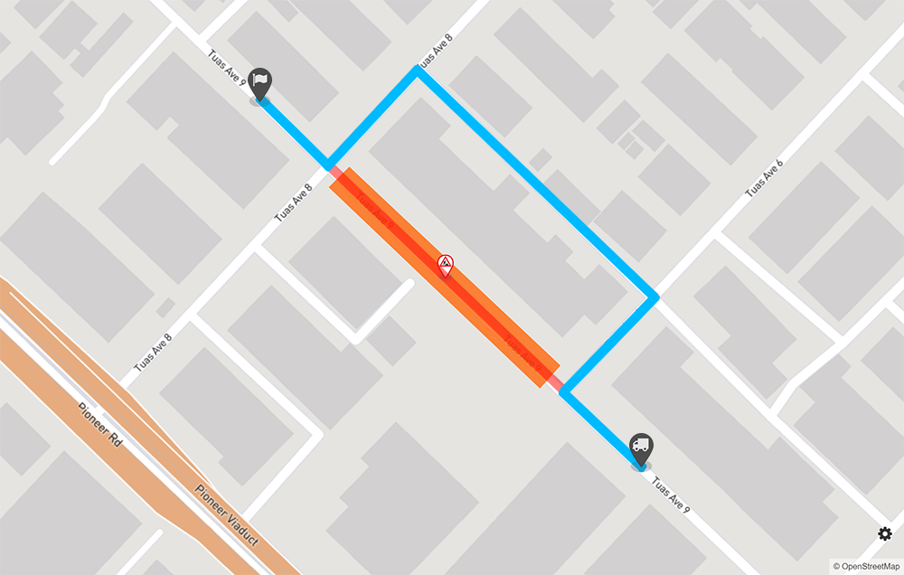
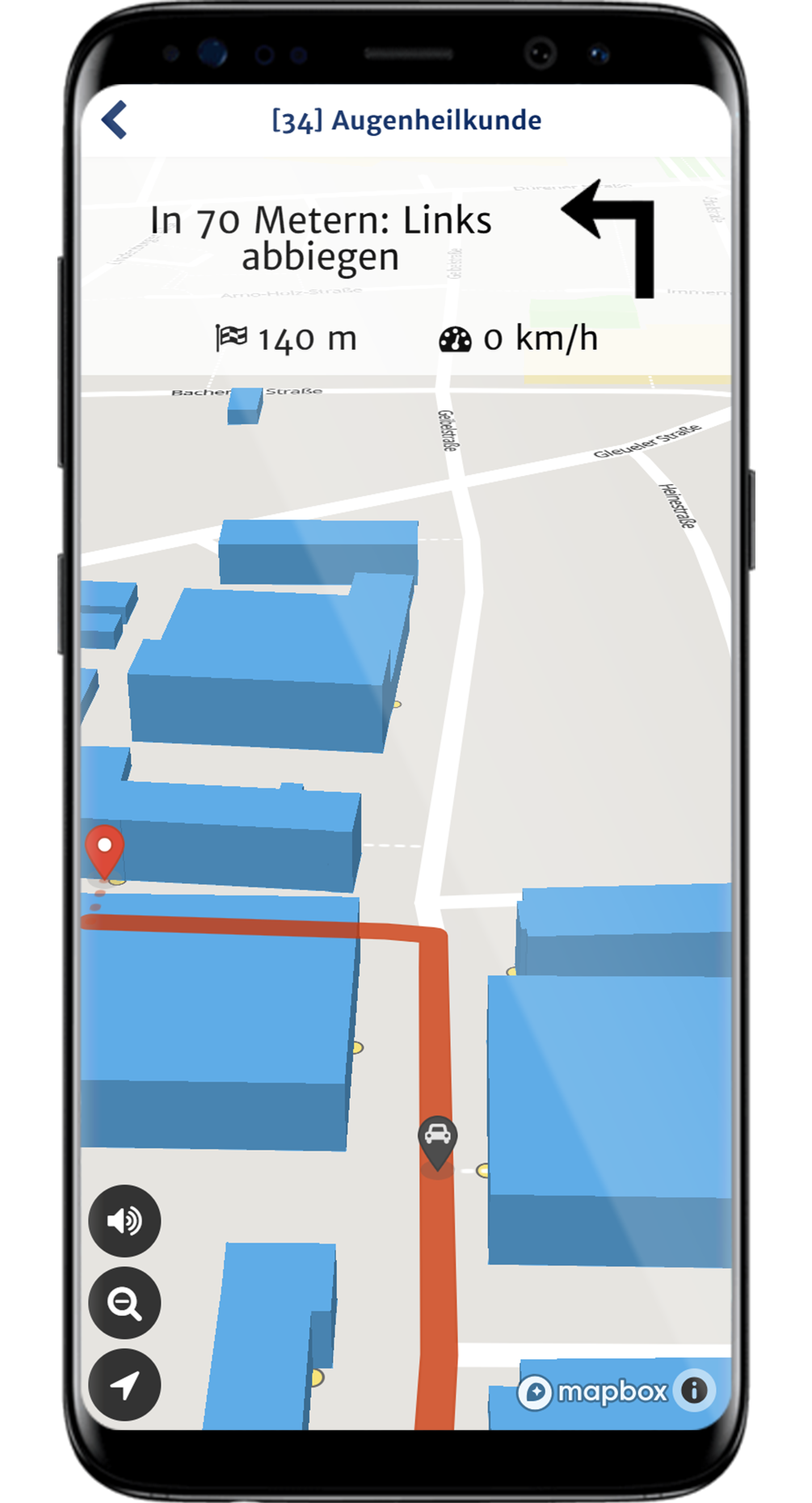
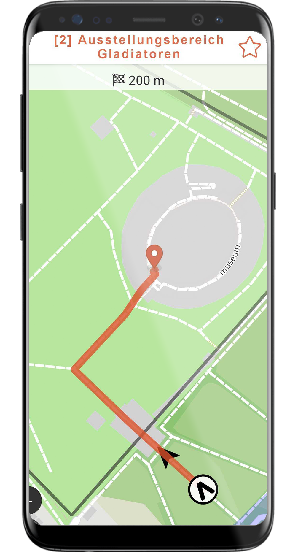
The app guides visitors, employees and suppliers safely from the gate to their destination (e.g. loading point) - even where normal navigation devices do not work. This makes paper maps obsolete.
Track the location of vehicles (live), write messages, assign loading points or send behavioral instructions (multilingual). There is no need to pick up vehicles manually from the waiting area or hand out notices on paper.
Paper forms have had their day! Carry out safety briefings, visitor or truck driver registrations or load securing documentations in a mobile, digital, audit-proof and contactless manner.
Sample reference: Saint-Gobain Rigips & Isover
With Tagxter's Site Guide System, we optimize truck dispatch at all RIGIPS and ISOVER sites in Germany. We have less communication effort with the drivers and can handle transports more efficiently. This reduces costs and relieves our employees.
Rely on a proven solution instead of developing a stand-alone solution. The Site Guide Navigation & Pager App offers an established digital standard that can be used very easily on all cooperating sites - without additional hardware.
The high level of user acceptance leads to positive reviews and smooth processes on site. The app is used by thousands of users on dozens of factory sites every day.
The pager function (chat) and flexible forms enable the digitalization of various processes, such as registrations, communication with truck drivers or calling truck drivers to the loading point.


Download Info PDF on digital yard management with the Tagxter Site Guide now:
Download PDF
The app offers 26 languages and automatic translation functions.
Saves time among employees/visitors/suppliers; avoids delays/follow-up costs.
Less "paperwork" thanks to digitization, no hardware required.
Blocking of EX zones, construction sites and hazardous areas possible in seconds.
Automatic recording of key figures such as the dispatch time.
Safety is increased by behavioral instructions, multilingual communication and safe navigation.
Inform you users about rules and regulations at specific moments of the navigation process.
Integration into existing software and telematics systems possible.
Don't develop insolated applications, use our established standard software.
Facilitate the orientation on your clinic or university campus for your patients, visitors, employees or students by providing them your own app based on the Site Guide!
Sample reference: Uniklinik Köln

Get an overview of your position and all accessible buildings/locations. With search function and filter you will find your destination.
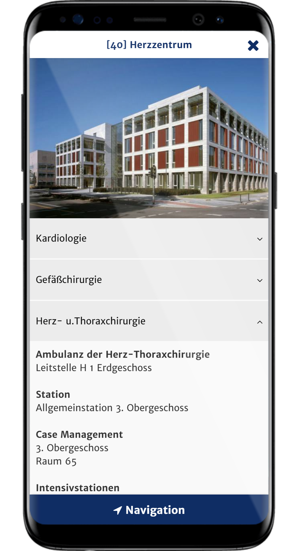
Additional information and media content are presented to inform the user in advance about the "Points of Interest".
Integrated navigation for pedestrians and vehicles with modifiable road network, taking construction zones or restricted areas into account.
Download info PDF now:
Site Guide for your clinic site (german)
Replaces maps by route calculation for pedestrians/vehicles.
Save yourself and your visitors valuable time in the visit process.
Blocking of construction zones and danger spots within the navigation only takes a few seconds.
The whole app content can be stored in any number of languages.
High initial investment is not necessary - you only pay a cheap monthly rental fee.
Contents can be conveniently entered in the browser or imported from your GIS.
Send current information via push notification directly to your visitors.
Through native developed Android and iOS apps and a webapp, we acheive almost 100% market coverage.
Tagxter takes care of operation, maintenance, support and further development.
Whether open-air museum, zoo, garden show or open day - we realize the app for your terrain or your event. Easily guide your guests to the individual "Points of Interest" on your site.
Sample reference: LVR-Archäologischer Park Xanten
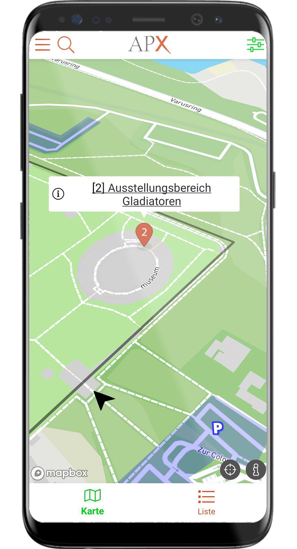
Get an overview of your position and all accessible buildings/locations. With search function and filter you will find your destination.
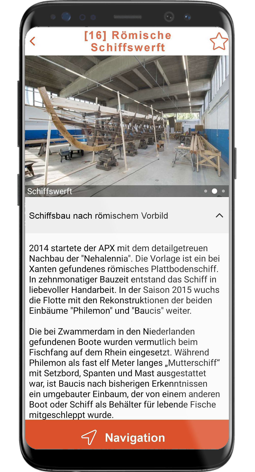
Additional information and media content are presented to inform the user in advance about the "Points of Interest".
Integrated navigation for pedestrians and vehicles with modifiable road network, taking construction zones or restricted areas into account.
The app replaces or complements your existing maps/flyers.
High initial investment is not necessary - you only pay a cheap monthly rental fee.
Send current information via push notification directly to your visitors.
The whole app content can be stored in any number of languages.
Filter and search function allow the user to find exactly the right content.
Content can be conveniently entered in the browser and changed live at any time.
The apps are adapted to your corporate identity and receive your desired name and your logo.
Through native developed Android and iOS apps and a webapp, we acheive almost 100% market coverage.
Tagxter takes care of operation, maintenance, support and further development.
Whether as part of your Site Guide app or as stand-alone solution - with the digital construction zone managament by Tagxter you will always be able to keep an eye on all construction activities and other restricted areas on your site. You can also embed them into your internal corporate communications. Possible use cases:
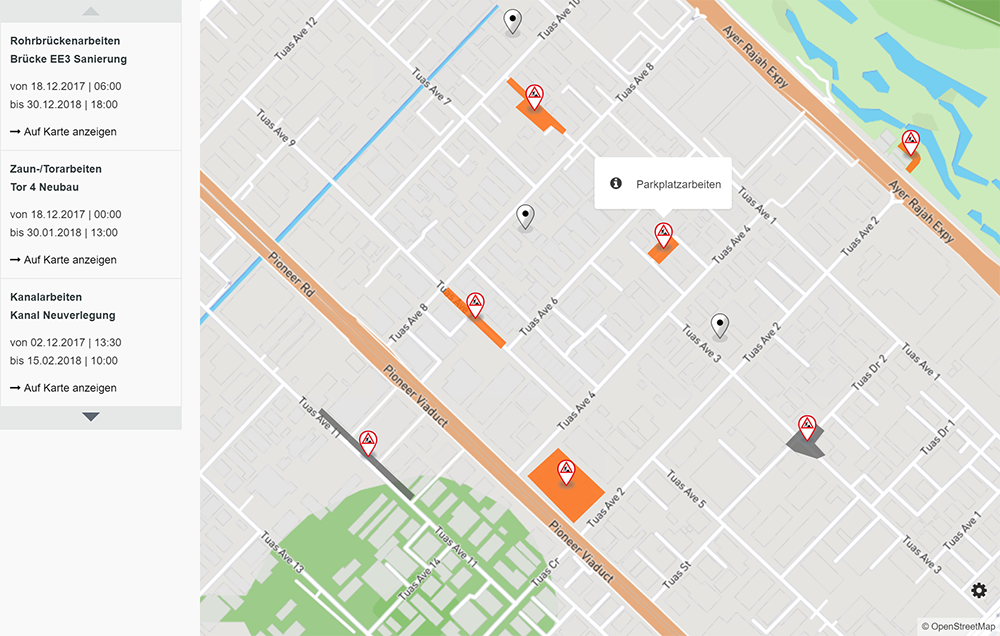
The dynamic overview map is web-based and can therefore be used almost everywhere, for example on the intranet via PC or on the go on your smartphone.
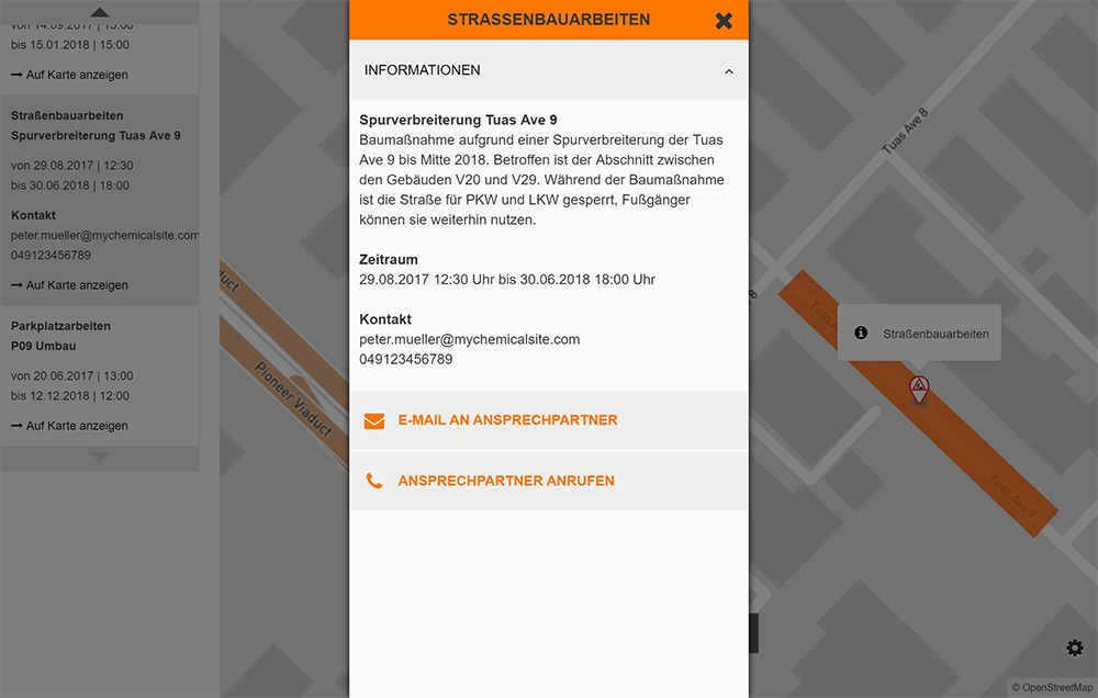
For all construction zones and special areas on your site, you can add extensive information and contact persons, which can be reached with just one click. The zones can be scheduled exactly and are (de)activated automatically at the specified time.
Different accesses with various authorizations and workflows can be created for different departments (factory safety, facility management, fire brigade etc.).
Your construction zone management will reach its full potential if you use the Site Guide apps on your site. All information about construction works can be automatically imported into your Site Guide.
The route calculation of the app also automatically takes into account all closures for the selected means of transportation (car/truck/pedestrian) and selects the fastest alternative route. Therefore, you no longer need to worry about how to communicate temporary closures and necessary diversions to all persons on your site - the Site Guide serves as a central information portal.